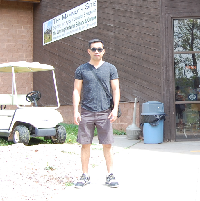
What I do: I am a geospatial scientist specializing in remote sensing of landscape dynamics, encompassing agriculture, soils, water, and landcover change, along with geostatistics, spatiotemporal analysis, and GeoAI. My work integrates satellite, airborne, and drone imagery with machine learning and hyperspectral techniques to address complex ecological and environmental challenges. I focus on biodiversity and ecological modeling, using advanced geospatial algorithms to explore key ecological processes, enhance our understanding of environmental patterns, and contribute to sustainability and conservation efforts.
Research & Teaching Interests
- Remote Sensing of Landscape Dynamics, GeoAI, Spatial Ecology and Environmental Applications, Geostatistics and Spatiotemporal Processes, Hyperspectral Imaging and Spectroscopy, LiDAR, Climate Science, GPS and GIS for Natural Resources
Education
PhD in GeoSpatial Science and Engineering, specialization in Remote Sensing Geography
South Dakota State University, Geospatial Sciences Center of Excellence, Brookings, South Dakota 57007, USA
- Dissertation: Evaluation and Application of a New Shape-sensitive Metric Useful for Characterizing Both Spectral Curves and Lidar Waveforms.
- Abstract: This dissertation seeks to investigate hyperspectral and waveform LiDAR datasets through a new analytical framework called Moment Distance method that uses a metric derived from the shape of the curve (spectral or waveform). In the case of hyperspectral data, the shape of the reflectance curve should unmask fine points of the spectra usually not considered by existing band-specific indices. To explore the advantages and shortcomings of this new approach, leaf and canopy hyperspectral reflectance samples were simulated using the physicallybased models PROSPECT (a leaf model) and SAIL (a canopy model). Sensitivity analysis was conducted with the goal of understanding the sensitivity of the new framework to leaf and canopy parameters relative to other existing and widely-used vegetation indices. The analysis evaluated the efficiency of the new approach to overcome, for instance, the decreased sensitivity of the NDVI at moderate to high Chl content or LAI. With waveform LiDAR data, the new approach was tested through the characterization of the canopy height without the typical step of fitting a series of Gaussian curves to the waveform to identify key peaks. Furthermore, the effects of noise and smoothing procedures on the metrics framework were assessed by introducing different types and levels of noise and various smoothing window sizes.
- Advisor: Dr. Geoffrey Henebry – Professor in the Department of Geography, Environment, and Spatial Sciences and the Center for Global Change and Earth Observations at Michigan State University. He is a member of two NASA Science Teams: Land Cover Land Use Change (LCLUC) and Biological Diversity and Ecological Conservation (BDEC).
- Committee Members:
- (1) Dr. Thomas Loveland (USGS/EROS) – Led the Landsat Continuity Mission Science Team and was a member of the NASA National Polar-orbiting Operational Environmental Satellite System (NPOESS) Preparatory Project science team.
- (2) Dr. Mark Cochrane (University of Maryland) – Conducts interdisciplinary work combining ecology, remote sensing, and other fields of study to provide an Earth systems perspective of the dynamic processes involved in global change.
- (3) Dr. Douglas Goodin (Kansas State University) – Professor and Director, Remote Sensing Research Laboratory. His research interests include understanding how selection of model parameters effects classification accuracy when using machine learning methods.
- (4) Dr. David Clay (South Dakota State University) – Distinguished Professor of Soil Science, Fellow of the American Society of Agronomy, and Editor for the Agronomy Journal. His research is focused on on-farm research, soil health, precision farming, landuse changes, water quality, and the development of Northern Great Plains Climate Smart agricultural systems.
Doctor of Public Administration (DPA)
(Dissertation needs to be defended)
DPA Certificate, Cebu Normal University, Jones Avenue, Cebu City, 6000 Philippines
Master of Science in Geo-Information (MSc GIS)
Wageningen University and Research, Laboratory of Geo-information Science and Remote Sensing, Wageningen, The Netherlands
Bachelor of Science in Civil Engineering (BSCE)
University of San Carlos, Cebu City, 6000 Philippines
Bachelor of Laws (LLB)
(Few courses taken and passed)
University of Cebu, Cebu City, 6000 Philippines
Research Experience
Research Geospatial Scientist
Central State University, Agricultural Research Development Program (ARDP), Wilberforce, Ohio 45384, USA
- NASA and Indian Space Research Organization (ISRO) Project. I integrate the Airborne Visible Infra-Red Imaging Spectrometer (AVIRIS-NG) data collected as part of a broader cooperative effort between NASA and Indian Space Research Organization (ISRO) with digital soil mapping techniques to predict soil carbon and its variability across different management regimes in the agricultural soils of India. This project hopes to provide rapid assessment of soil carbon as impacted by agricultural management systems using airborne hyperspectral imaging.
Postdoctoral Research Geospatial Scientist
New Mexico State University, Fish, Wildlife and Conservation Ecology, South Espina, Knox Hall 132, Las Cruces, New Mexico, USA
- Connected at the Center for Applied Spatial Ecology (CASE) laboratory under Dr. Kenneth Boykin. The goal of the laboratory is to provide technical and biological knowledge and expertise to support natural resource management across spatial and temporal scales. Current projects include:
- Land Cover Mapping in Tajikistan. I use advanced tools to interpret satellite imagery using environmental datasets and machine learning methods to create a land cover/land use map for the Pamir Mountains in Tajikistan. Further, I employ species distribution modelling and apply remote sensing for biodiversity estimate.
- South Central U.S. Climate Science Center Species Modeling. I assess the impact that varying climate for the New Mexico, Oklahoma, Texas, and Arizona will have on the distribution of key terrestrial vertebrate species. This includes developing models of present and potential future distributions of suitable conditions for the focal species. This project and our lab team is in collaboration with NOAA’s Geophysical Fluid Dynamics Laboratory (GFDL) Statistical Downscaling Research Team. Results of the project are available for download via USGS ScienceBase: Projected Future Bioclimate-Envelope Suitability for Species of Concern in South Central USA. Most importantly, results of the models are integrated into the New Mexico Crucial Habitat Assessment Tool (NM CHAT) Web Portal using a new index called Relative Diversity Loss Index (RDLI).
- U.S. Bureau of Land Management (BLM) Project. I assess the effects of various environmental variables on the distribution of flora and fauna (about 150 species) in the Organ Mountains-Desert Peaks National Monument through species modeling.
Postdoctoral Research Fellow
South Dakota State University, Geospatial Sciences Center of Excellence (GSCE), Brookings, South Dakota, USA
- Waveform LiDAR. I analyzed the application of the Moment Distance Index (MDI) to Light Detection and Ranging (LiDAR) waveform. I assessed the relationship of the MDI metrics to some key waveform landmarks – such as locations of peaks, power of returns, and pseudo-heights. See: How to Calculate MDI or Compute Moment Distance Index.
Graduate Research Assistant
South Dakota State University, Geographic Information Science Center of Excellence (GIScCE), Brookings, South Dakota, USA
- Worked with my PhD advisor Dr. Geoffrey Henebry in various projects including the Sand Hills Biocomplexity project in Nebraska and the LiDAR project using datasets from La Selva Biological Research Station in Costa Rica.
Teaching Experience
Instructor
New Mexico State University, Fish, Wildlife and Conservation Ecology, South Espina, Knox Hall 132, Las Cruces, New Mexico, USA
- Taught GIS for Natural Resources Scientists (FWCE 471/571) and Seminar on Natural Resources Management (FWCE 402). See class page.
Graduate Teaching Assistant
South Dakota State University, Geographic Information Science Center of Excellence (GIScCE), Brookings, South Dakota, USA
- Taught Introduction to Remote Sensing with Dr. Thomas Loveland.
Assistant Professor and Researcher
University of San Carlos, Technological Center, Civil Engineering Department
Talamban, Cebu City, Philippines
- Taught Engineering Mathematics, Engineering Mechanics, Strength of Materials, Differential and Integral Calculus, Geotechnics, Basic and Higher Surveying, Planning and Transportation subjects, GIS and Remote Sensing
Work and Employment
GIS Specialist – Surveying Project
Bohol Mining Corporation, Bohol, Philippines
Design Engineer
Tsuneishi Technical Services Philippines, Inc., Cebu City, Philippines
Production Engineer and Estimator
DN Steel Marketing Inc., Mandaue City, Philippines
Academic and Professional Service
Special Issue Editor: “Applications of Remote Sensing in Spatial Ecology” – Remote Sensing Journal
See: https://www.mdpi.com/journal/remotesensing/special_issues/35BWN7JY78
Reviewer: Journal of Arid Environments, Remote Sensing, Geosciences, PLOS ONE, PeerJ
See: https://publons.com/author/1049648/eric-ariel-l-salas#profile
Topic Editor –Agronomy Journal
https://www.mdpi.com/journal/agronomy/topic_editors
Reviewer Board – Remote Sensing Journal
https://www.mdpi.com/journal/remotesensing/submission_reviewers
Head Judge for Senior Earth and Planetary Sciences category, Science & Engineering Fair, NMSU Corbett Center Ballrooms, Las Cruces, NM. March 4, 2017.
Skills and Software Experience
ENVI/IDL, R, Python, Web APIs, ArcGIS Desktop, ERDAS IMAGINE, IDRISI, Maxent, VisTrails/SAHM, Adobe Tools, MS Publisher, Web Design
Writing Sideline
Columnist
The Collegian, South Dakota State University, Brookings, South Dakota, USA
Contributing Writer
Sun-Star Weekend Magazine, Sun-Star Newspaper, Cebu City, Philippines
The Freeman Newspaper, Lifestyle Section, Cebu City, Philippines (contributed a number of articles)
Philippine Daily Inquirer, Youngblood Section, Manila Philippines (contributed a number of articles)

