Customize Consent Preferences

We use cookies to help you navigate efficiently and perform certain functions. You will find detailed information about all cookies under each consent category below.

The cookies that are categorized as "Necessary" are stored on your browser as they are essential for enabling the basic functionalities of the site. ... 

Always Active

Necessary cookies are required to enable the basic features of this site, such as providing secure log-in or adjusting your consent preferences. These cookies do not store any personally identifiable data.

No cookies to display.

Functional cookies help perform certain functionalities like sharing the content of the website on social media platforms, collecting feedback, and other third-party features.

No cookies to display.

Analytical cookies are used to understand how visitors interact with the website. These cookies help provide information on metrics such as the number of visitors, bounce rate, traffic source, etc.

No cookies to display.

Performance cookies are used to understand and analyze the key performance indexes of the website which helps in delivering a better user experience for the visitors.

No cookies to display.

Advertisement cookies are used to provide visitors with customized advertisements based on the pages you visited previously and to analyze the effectiveness of the ad campaigns.

No cookies to display.

How To Highlight A Country in Google Earth

If you want to highlight a country of interest using Google Earth, you may get disappointed. Google Maps/Google Earth lacks the coloring/highlighting feature. But is there a way to color the country polygons?

Yes. Try third party online tools!

One tool I found is the Zonums Solutions. It is a free online utility that “colors your map” based on the province or state. You can do the highlighting in both Google Maps and Google Earth.

Screenshot:
Zonums Solutions

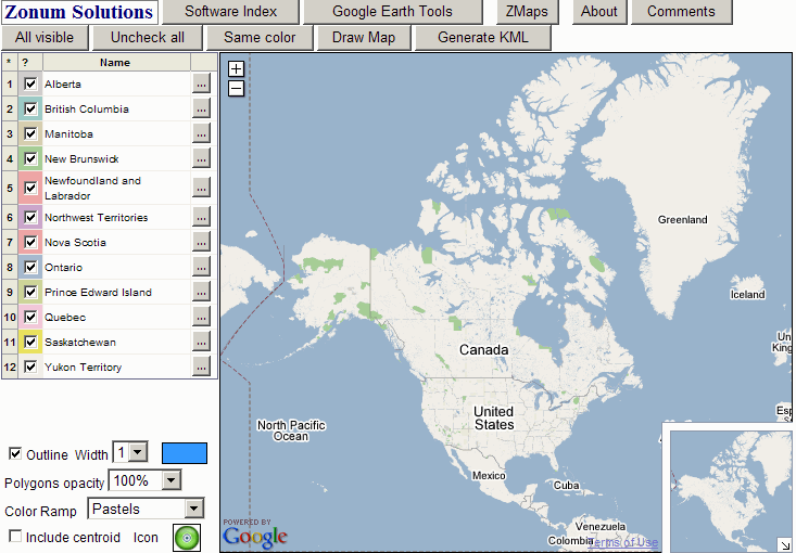
Access the tool: Color Your Map.

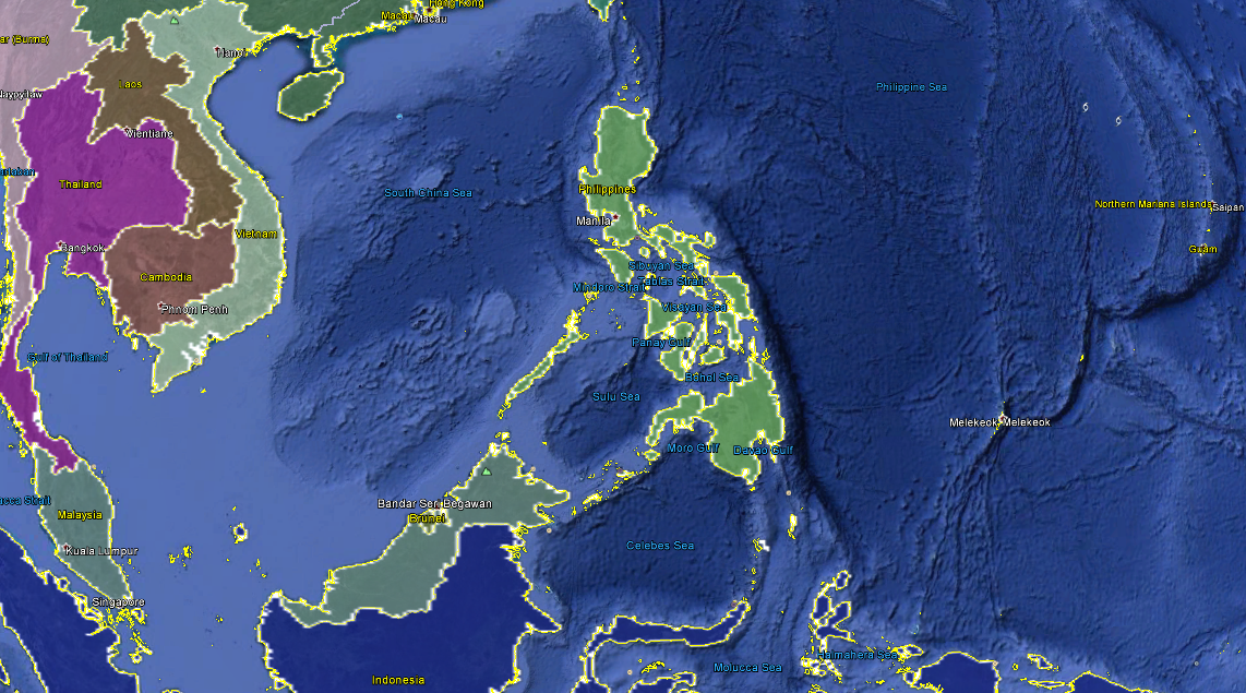
If you have installed Google Earth installed in your PC, one way to highlight the countries or their boundaries is to run a KML file. Developer, Devin R. Olsen, came up with the KML files that you can use. It is pretty cool. With just few steps to follow, you are on your way to coloring your country of interest.

Access the tool: Using Google Earth Borders as Google Maps Polygons

Color-country-google-earth

If you know of some other tools, leave a comment below.

Leave a Reply

Your email address will not be published. Required fields are marked *

nine − 6 =

This site uses Akismet to reduce spam. Learn how your comment data is processed.